Official Name:
ОеТ»ПыК§іӨіЗWuYiXiaoShiChangChengOur Name:
ұЯЗҪ / BianQiang
Other Name:
/
Period:Гч
/ Ming Dynasty 1368~1644
Location: ёКЛаКЎ,ХЕТҙКР,ёЯМЁПШ,ЖрөгЈәБЩФуПШЖҪҙЁХтјЦјТ¶ХҙеУлёЯМЁПШәПАиПзОеТ»ҙеҪ»ҪзҙҰОеТ»ҙе°ЛЙзұұІаФј500ГЧҙҰЦ№өгЈәәПАиПзОе¶юҙеТ»Й綫ұұІа500ГЧҙҰ / GanSuSheng,ZhangYeShi,GaoTaiXian,QiDianLinZeXianPingChuanZhenJiaJiaDunCunYuGaoTaiXianHeLiXiangWuYiCunJiaoJieChuWuYiCunBaSheBeiCeYue500MiChuZhiDianHeLiXiangWuErCunYiSheDongBeiCe500MiChu
ЎЎ[
Looking Local List]
Details:іӨіЗАаұрЈәЗҪМе
ЖрөгҫӯОіёЯ¶ИЈә¶«ҫӯЈә099Ўг 56Ўд ұұОіЈә39Ўг 22Ўд әЈ°ОЈә1357
ЦХөгҫӯОіёЯ¶ИЈә¶«ҫӯЈә099Ўг 55Ўд ұұОіЈә39Ўг 22Ўд әЈ°ОЈә1353
ЗҪМеЧЯПтЈәҫӯЧЯ·ГөұөШ°ЩРХөГЦӘЈ¬ФӯЗҪМеЖрөгО»УЪБЩФуПШЖҪҙЁХтјЦјТ¶ХҙеҫУГсөШТФұұёыөШјдЈ¬ЧФјЦјТ¶ХҙеКјЈ¬ЦРНҫИЖ№эұұЙҪІРЗрөШҙшЈ¬ПИәуҫӯ№эёЯМЁПШәПАиПзОеТ»ҙеТ»ЙзЎў¶юЙзЎўЖЯЙзПҪЗшЈ¬ФЪҫУГсөШТФұұФј1З§ГЧҙҰөДёыөШјдСУЙмЈ¬Ц№өгФЪОеТ»ҙе°ЛЙзҫУГсөШТФұұФј500ГЧҙҰЎЈЧЬМеЧЯПтУЙ¶«ПтОчСУЙмЈ¬ҙУЖрөгЦБ988ГЧҙҰЧӘОӘУЙ¶«ДППтОчұұ·ҪПтСУЙмЈ¬ХЫөгЧшұкөЪ0002өгЎЈ
ЗҪМеАаұрј°№№Цю·ҪКҪЈәІ»ПкЎЈ
ЗҪМеАаұрЈәПыК§өДіӨіЗ
Ҫб№№МШөгј°№№Цю·ҪКҪЈәІ»ПкЎЈІ»ПкЎЈ
ПЦЧҙЈә
Type:ПыК§өДіӨіЗ Disappeared wall
Protection Level:ЎЎ
Content:
Memo:
Other Records:
Distribution:
visit location in Tianditu Map[recommend] Distribution:
visit location in Tencent QQ Map Distribution:
visit location in Google MapDistribution:
visit location in Baidu MapNational ID:620724382301170001
Action:[
 Save in Data Basket
 ]
Picture:
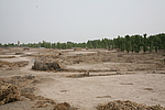
Click the thumbnail to view the Big Pic. Click the Big Pic to Hide the Big Pic![Caption:ОеТ»ПыК§іӨіЗ
loading images --Please wait...]()
![Caption:ОеТ»ПыК§іӨіЗ
loading images --Please wait...]() Photo Links
Photo Links:
ЎЎ Search ::
  Favorite/My Favorite :: Recent Changes :: :: Login