Official Name:
贾家墩消失长城JiaJiaDunXiaoShiChangChengOur Name:
/
Other Name:
/
Period:明
/ Ming Dynasty 1368~1644
Location: 甘肃省,张掖市,临泽县,起点:平川镇三三村十二社南侧200米处止点:平川镇贾家村六社西侧1千米处峡谷东崖边 / GanSuSheng,ZhangYeShi,LinZeXian,QiDianPingChuanZhenSanSanCunShiErSheNanCe200MiChuZhiDianPingChuanZhenJiaJiaCunLiuSheXiCe1QianMiChuXiaGuDongYaBian
[
Looking Local List]
Details:长城类别:墙体
起点经纬高度:东经:099° 57′ 北纬:39° 22′ 海拔:1361
终点经纬高度:东经:099° 56′ 北纬:39° 22′ 海拔:1359
墙体走向:经走访当地居民得知原墙体总体由东北至西南延伸。起点在平川镇三三村十二社南侧200米处,先后经过三三村八、七、六社和贾家墩村九、八、七、六社居民地以南约100米处的耕地间,止点在平川镇贾家村六社西侧1千米处峡谷东崖边。
此消失段起自第0091点,止于第0093点,全长2152米。中途采集第0092点为节点。
墙体类别及构筑方式:无。
墙体类别:消失的长城
结构特点及构筑方式:无。不详。
现状:
Type:消失的长城 Disappeared wall
Protection Level:
Content:
Memo:
Other Records:
Distribution:
visit location in Tianditu Map[recommend] Distribution:
visit location in Tencent QQ Map Distribution:
visit location in Google MapDistribution:
visit location in Baidu MapNational ID:620723382301170034
Action:[
 Save in Data Basket
 ]
Picture:
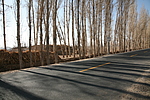
Click the thumbnail to view the Big Pic. Click the Big Pic to Hide the Big Pic![Caption:贾家墩消失长城
loading images --Please wait...]()
![Caption:贾家墩消失长城
loading images --Please wait...]() Photo Links
Photo Links:
 Search ::
  Favorite/My Favorite :: Recent Changes :: :: Login