Welcome you Visit www.thegreatwall.com.cn!!     Location:EN Version->The Great Wall Architecture and Geographical Information Database[ Login ]/[ Register ]  
 Home :: Regional Index :: List :: Search :: My Data Basket :: Favorite/My Favorite :: Recent Changes :: :: Login
Official Name:双丰壕堑2段
ShuangFengHaoQian2Duan
Our Name:壕沟 / HaoGou
Other Name: /
Period:明 / Ming Dynasty 1368~1644
Location: 甘肃省,张掖市,高台县,起点:罗城乡双丰村村委会东侧约8.88千米,北距元明粉厂约4.8千米止点:罗城乡双丰村村委会东北侧4.64千米 / GanSuSheng,ZhangYeShi,GaoTaiXian,QiDianLuoChengXiangShuangFengCunCunWeiHuiDongCeYue888QianMiBeiJuYuanMingFenChangYue48QianMiZhiDianLuoChengXiangShuangFengCunCunWeiHuiDongBeiCe464QianMi
         [Looking Local List]
Details:长城类别:界壕壕堑 起点经纬高度:东经:° ′ 北纬:° ′ 海拔: 终点经纬高度:东经:° ′ 北纬:° ′ 海拔: 墙体走向: 墙体类别:壕堑 结构特点及构筑方式:壕堑上宽18米-22米,底宽8米-12米,残深0.40米-1.80米,南垄底宽8米-10米,顶宽3米-6米,残高0.40米-1.20米,北垄底宽9米-12米,顶宽4米-6米,残高0.50米-1.40米。 本段起自第0306点,止于第0311点,全长4401米。据保存现状共分为4个自然段。 第一自然段:起自第0306点,止于第0308点,长1670米。地处盐碱地段,地下水位高,在1米-4米之间,地表返潮、酥碱、湿润,土质灰白,结甲成壳,一踩即塌陷,浮土酥松棉软。 南北两垄呈宽阔、低矮、平缓的脊垄状,高低不平,宽窄不一,起伏蜿蜒。壕堑内外长有耐碱灌丛和芦芽、果刺等杂草,壕内淤土蓄积,土质酥软,较平坦通畅,深浅宽窄基本一致。 从起点至820米处始,之后壕堑内淤土渐渐增高,深度变浅,残深0.40米-1米。至1250米处,有一条宽4米的车路南北向横穿而过,车路以西南北两垄宽大平缓、低矮,走向、形制清晰,壕内淤土蓄积但平坦通畅,内外长满红柳、果刺灌丛和杂草。 至1.43千米处,有长20米的壕堑,壕内淤土蓄积,与南北两垄基本平齐,因雨水冲刷,使两壕垄堆土向沟内散漫所致。 至1510米处,壕内堆积有3处小沙丘,直径5米-8米,高2米-2.50米,上面长满果刺、芦芽灌丛。至1660米处,在南垄边5米处,建有双丰1号烽火台(第0307点),呈土包状残存。 第二自然段:起自第0308点,止于第0309点,长35米。是人为挖掘修建铁路时所毁,现有清水至酒泉航天城铁路专线南北向从中穿过,铁路西侧20米处,有一条通讯线路与之并行,8米处有一道电缆埋设在底下。 第三自然段:起自第0309点,止于第0310点,长316米,壕堑内外长满杂草,淤土蓄积但平坦通畅,两垄宽大低矮,微凸出于地表,堙隐在草丛中,残高0.30米-0.50米,有的基本与地表平齐,难以看清,须借助航拍片判定,才能辨识其形迹和走向。至末端两垄隐约模糊,消失在沙丘和草丛中。 第四自然段:起自第0310点,止于第0311点,长2380米。是被洪水冲毁或被流动的沙丘所堙埋,起端以西50米处,有一条干河床南北向穿过,杂草丛生,地势高低起伏,有小沙包密布。 第0311点是双丰壕堑2段的止点,也是双丰壕堑3段的起点. 与周边长城墙体、烽火台、关堡等的位置关系:东南接盐池消失壕堑2段,西北与双丰壕堑3段相连,北侧4.87千米处,有盐池壕堑5段与之并行。从起点至1660米处,在壕堑南侧5米处建有双丰1号烽火台(第0307点)。 现状:
Type:
Protection Level: 
Content:
Memo:
Other Records:
Distribution:visit location in Tianditu Map[recommend]
Distribution:visit location in Tencent QQ Map
Distribution:visit location in Google Map
Distribution:visit location in Baidu Map
National ID:620724382202170014
Action:[ Save in Data Basket ]
Picture: Click the thumbnail to view the Big Pic. Click the Big Pic to Hide the Big Pic
双丰壕堑2段     
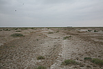
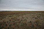
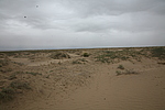
Caption:双丰壕堑2段
Photo Time:2008-09-23 17:27:40
Photo Contributor:甘肃省文物局
[Open in New Window]  
Caption:双丰壕堑2段
loading images --Please wait...
双丰壕堑2段     
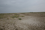
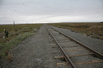
Caption:双丰壕堑2段
Photo Time:2008-09-23 17:44:45
Photo Contributor:甘肃省文物局
[Open in New Window]  
Caption:双丰壕堑2段
loading images --Please wait...
双丰壕堑2段     
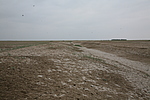
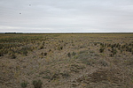
Caption:双丰壕堑2段
Photo Time:2008-09-23 17:52:31
Photo Contributor:甘肃省文物局
[Open in New Window]  
Caption:双丰壕堑2段
loading images --Please wait...
双丰壕堑2段     
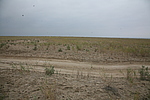
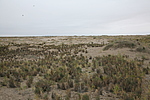
Caption:双丰壕堑2段
Photo Time:2008-09-23 18:11:37
Photo Contributor:甘肃省文物局
[Open in New Window]  
Caption:双丰壕堑2段
loading images --Please wait...
双丰壕堑2段     Caption:双丰壕堑2段
Photo Time:2008-09-24 10:11:49
Photo Contributor:甘肃省文物局
[Open in New Window]  
Caption:双丰壕堑2段
loading images --Please wait...
双丰壕堑2段     Caption:双丰壕堑2段
Photo Time:2008-09-24 10:26:06
Photo Contributor:甘肃省文物局
[Open in New Window]  
Caption:双丰壕堑2段
loading images --Please wait...
双丰壕堑2段     Caption:双丰壕堑2段
Photo Time:2008-09-24 10:38:30
Photo Contributor:甘肃省文物局
[Open in New Window]  
Caption:双丰壕堑2段
loading images --Please wait...
双丰壕堑2段     Caption:双丰壕堑2段
Photo Time:2008-09-24 10:43:13
Photo Contributor:甘肃省文物局
[Open in New Window]  
Caption:双丰壕堑2段
loading images --Please wait...
双丰壕堑2段     Caption:双丰壕堑2段
Photo Time:2008-09-24 11:58:39
Photo Contributor:甘肃省文物局
[Open in New Window]  
Caption:双丰壕堑2段
loading images --Please wait...
Photo Links:

 the Page History :: Edit Photo :: Manager Area: Confirm :: Restore :: Delete
 评论/讨论/留言区 :: 发表新帖 :: 刷新 :: 回到顶部
 留言总数0帖 页次:1/0 每页:20条 
v0.1 2003; v1.3 2022.05 ; © 2003~2022,www.thegreatwall.com.cn