Welcome you Visit www.thegreatwall.com.cn!!     Location:EN Version->The Great Wall Architecture and Geographical Information Database[ Login ]/[ Register ]  
 Home :: Regional Index :: List :: Search :: My Data Basket :: Favorite/My Favorite :: Recent Changes :: :: Login
Official Name:盐池壕堑2段
YanChiHaoQian2Duan
Our Name:壕沟 / HaoGou
Other Name: /
Period:明 / Ming Dynasty 1368~1644
Location: 甘肃省,张掖市,高台县,起点:罗城乡盐池村东北侧9.5千米处止点:罗城乡盐池村东北侧5.5千米处戈壁荒滩上 / GanSuSheng,ZhangYeShi,GaoTaiXian,QiDianLuoChengXiangYanChiCunDongBeiCe95QianMiChuZhiDianLuoChengXiangYanChiCunDongBeiCe55QianMiChuGeBiHuangTanShang
         [Looking Local List]
Details:长城类别:界壕壕堑 起点经纬高度:东经:° ′ 北纬:° ′ 海拔: 终点经纬高度:东经:° ′ 北纬:° ′ 海拔: 墙体走向: 墙体类别:壕堑 结构特点及构筑方式:壕堑上宽8米-14米,底宽1米-5米,北垄底宽4-13米,顶宽0.30米-1.50米,残高0.80米-2.50米,南垄底宽8米-12米,顶宽0.30米-1.10米,残高2米-3.80米。 本段起自第0199点,止于第0212点。全长4361米。据保存状况共分为12个自然段。 第一自然段:起自第0199点,止于第0200点,长1020米。在起点南垄内侧,有10米的沙石土方,被人为挖掘成坑,从起点至408米处,南北两垄被洪水冲开宽2米的豁口。 第二自然段:起自第0200点,止于第0201点,长20米,是洪水冲毁,南北两垄不存,壕堑内被泥沙填满与地表平齐,有一道洪水河床从中穿过。 第三自然段:起自第0201点,止于第0203点,长1450米,从起点至256米处,南垄被洪水冲毁2米,北垄被洪水冲毁4米,有一道干河床从中穿过。 可见壕堑典型剖面呈倒梯形,壕堑上宽14米,底宽3米,深2米,南垄底宽9米,顶宽1米,高2米,北垄底宽7米,顶宽0.40米,高1米,表面布满细小砾石。 从起点至368米处,在壕堑南侧7米处,建有盐池3号烽火台(第0202点)。 距起点635米处,壕堑南垄被洪水冲毁11米,北垄东端被洪水冲毁32米,西端被洪水冲毁70米。 距起点740米处,北垄被洪水冲毁100米。从起点至820米处,南垄被洪水冲出6米的豁口。 从起点至1.07千米处,北垄被冲毁100米。从起点至1.17千米处,南垄被冲毁40米。 从起点至1.23千米处,有一道东南至西北的拦洪坝与壕堑北垄连通,长约200米,将大量洪水拦入壕堑内,从第三自然段起点至1.17千米处,从南垄的豁口处向南侧戈壁排出。 第四自然段:起自第0203点,止于第0204点,长31米,起点处南垄被洪水冲毁31米,北垄被洪水冲毁6米。 第五自然段:起自第0204点,止于第0205点,长723米,从起点至340米处,有一道洪水河床从中穿过,壕堑南北两垄被冲出宽7米的豁口。从起点至620米处,北垄被冲毁12米。 第六自然段:起自第0205点,止于第0206点,长25米,现有一道干河床从中穿过。 第七自然段:起自第0206点,止于第0207点,长250米。壕堑上宽8米-12米,底宽2米-5米,南垄底宽7米-13米,残高1.20米-2.80米,顶宽0.60米-1.20米,北垄底宽4米-12米,顶宽0.50米-1.50米,残高0.80米-2米,壕内填有淤沙,垄上长有灌木和杂草,垄沿夹杂黄土和碎砾石堆积,高低起伏。 第八自然段:起自第0207点,止于第0208点,长22米,现有一条洪水河床从中穿过。 第九自然段:起自第0208点,止于第0209点,长280米。壕内填有淤沙,深浅不一,上宽13米-15米,底宽1米-2米,南垄底宽8米-1米,顶宽0.60米-11米,残高1.80米-2.80米,北垄底高6米-9米,顶宽1米-1.40米,残高1.50米-2.50米。在南壕垄起端,有人为筛取石料的沙堆和坑窝,垄沿呈斜坡状,长有杂草。距起点190米处,北垄消失,系洪水冲毁。 第十自然段:起自第0209点,止于第0210点,长220米,壕堑消失。洪水冲毁,现有洪水河床分布其间。第0210点也是壕堑走向的拐点,自此点始,壕堑走向由东向西偏南转为由东向西偏北方向延伸。 第十一自然段:起自第0210点,止于第0211点,长300米,壕堑上宽9米-14米,底宽2米-4米。南垄底宽8米-10米,顶宽1米-2米,残高1.20米-2米。从本段开始,北垄再度出现,底宽8米-11米,顶宽0.40米-1.20米,残高1米-2米,壕内填有淤沙,垄沿两面斜坡,长有杂草。 第十二自然段:起自第0211点,止于第0212点,长20米,该段壕堑消失。洪水冲毁,其间有一道干河床。 第0212点是盐池壕堑2段的止点,也是盐池壕堑3段的起点。 与周边长城墙体、烽火台、关堡等的位置关系:东北接盐池壕堑1段,西南与盐池壕堑3段相接,从第三自然段起点至368米处,在壕堑南侧7米处建有盐池3号烽火台。 现状:
Type:
Protection Level: 
Content:
Memo:
Other Records:
Distribution:visit location in Tianditu Map[recommend]
Distribution:visit location in Tencent QQ Map
Distribution:visit location in Google Map
Distribution:visit location in Baidu Map
National ID:620724382202170003
Action:[ Save in Data Basket ]
Picture: Click the thumbnail to view the Big Pic. Click the Big Pic to Hide the Big Pic
盐池壕堑2段     
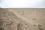
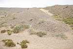
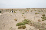
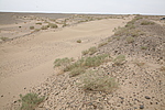
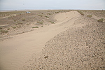
Caption:盐池壕堑2段
Photo Time:2008-05-21 09:26:51
Photo Contributor:甘肃省文物局
[Open in New Window]  
Caption:盐池壕堑2段
loading images --Please wait...
盐池壕堑2段     
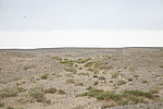
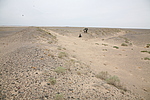
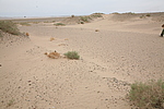
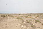
Caption:盐池壕堑2段
Photo Time:2008-05-21 10:03:44
Photo Contributor:甘肃省文物局
[Open in New Window]  
Caption:盐池壕堑2段
loading images --Please wait...
盐池壕堑2段     
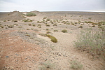
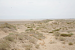
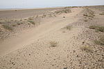
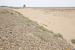
Caption:盐池壕堑2段
Photo Time:2008-05-21 10:11:12
Photo Contributor:甘肃省文物局
[Open in New Window]  
Caption:盐池壕堑2段
loading images --Please wait...
盐池壕堑2段     
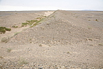
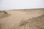
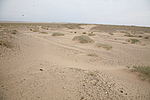
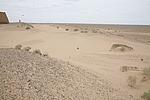
Caption:盐池壕堑2段
Photo Time:2008-05-21 10:17:56
Photo Contributor:甘肃省文物局
[Open in New Window]  
Caption:盐池壕堑2段
loading images --Please wait...
盐池壕堑2段     Caption:盐池壕堑2段
Photo Time:2008-05-21 10:18:18
Photo Contributor:甘肃省文物局
[Open in New Window]  
Caption:盐池壕堑2段
loading images --Please wait...
盐池壕堑2段     
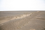
Caption:盐池壕堑2段
Photo Time:2008-05-21 11:12:06
Photo Contributor:甘肃省文物局
[Open in New Window]  
Caption:盐池壕堑2段
loading images --Please wait...
盐池壕堑2段     Caption:盐池壕堑2段
Photo Time:2008-05-21 11:30:13
Photo Contributor:甘肃省文物局
[Open in New Window]  
Caption:盐池壕堑2段
loading images --Please wait...
盐池壕堑2段     Caption:盐池壕堑2段
Photo Time:2008-05-21 11:35:13
Photo Contributor:甘肃省文物局
[Open in New Window]  
Caption:盐池壕堑2段
loading images --Please wait...
盐池壕堑2段     
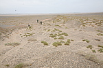
Caption:盐池壕堑2段
Photo Time:2008-05-21 12:02:54
Photo Contributor:甘肃省文物局
[Open in New Window]  
Caption:盐池壕堑2段
loading images --Please wait...
盐池壕堑2段     Caption:盐池壕堑2段
Photo Time:2008-05-21 12:10:14
Photo Contributor:甘肃省文物局
[Open in New Window]  
Caption:盐池壕堑2段
loading images --Please wait...
盐池壕堑2段     Caption:盐池壕堑2段
Photo Time:2008-05-21 12:15:19
Photo Contributor:甘肃省文物局
[Open in New Window]  
Caption:盐池壕堑2段
loading images --Please wait...
盐池壕堑2段     Caption:盐池壕堑2段
Photo Time:2008-05-21 12:31:14
Photo Contributor:甘肃省文物局
[Open in New Window]  
Caption:盐池壕堑2段
loading images --Please wait...
盐池壕堑2段     
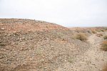
Caption:盐池壕堑2段
Photo Time:2008-05-21 14:22:51
Photo Contributor:甘肃省文物局
[Open in New Window]  
Caption:盐池壕堑2段
loading images --Please wait...
盐池壕堑2段     Caption:盐池壕堑2段
Photo Time:2008-05-21 14:23:10
Photo Contributor:甘肃省文物局
[Open in New Window]  
Caption:盐池壕堑2段
loading images --Please wait...
盐池壕堑2段     Caption:盐池壕堑2段
Photo Time:2008-05-21 14:26:58
Photo Contributor:甘肃省文物局
[Open in New Window]  
Caption:盐池壕堑2段
loading images --Please wait...
盐池壕堑2段     Caption:盐池壕堑2段
Photo Time:2008-05-21 14:38:00
Photo Contributor:甘肃省文物局
[Open in New Window]  
Caption:盐池壕堑2段
loading images --Please wait...
盐池壕堑2段     Caption:盐池壕堑2段
Photo Time:2008-05-21 14:41:55
Photo Contributor:甘肃省文物局
[Open in New Window]  
Caption:盐池壕堑2段
loading images --Please wait...
盐池壕堑2段     Caption:盐池壕堑2段
Photo Time:2008-05-21 14:48:15
Photo Contributor:甘肃省文物局
[Open in New Window]  
Caption:盐池壕堑2段
loading images --Please wait...
盐池壕堑2段     Caption:盐池壕堑2段
Photo Time:2008-05-21 14:58:48
Photo Contributor:甘肃省文物局
[Open in New Window]  
Caption:盐池壕堑2段
loading images --Please wait...
盐池壕堑2段     Caption:盐池壕堑2段
Photo Time:2008-05-21 15:08:06
Photo Contributor:甘肃省文物局
[Open in New Window]  
Caption:盐池壕堑2段
loading images --Please wait...
Photo Links:

 the Page History :: Edit Photo :: Manager Area: Confirm :: Restore :: Delete
 评论/讨论/留言区 :: 发表新帖 :: 刷新 :: 回到顶部
 留言总数0帖 页次:1/0 每页:20条 
v0.1 2003; v1.3 2022.05 ; © 2003~2022,www.thegreatwall.com.cn