Official Name:
靠山屯西山烽火台KaoShanTunXiShanFengHuoTaiOur Name:
/
Other Name:
/
Period:明 / Ming Dynasty 1368~1644
Location: 铁岭市,开原市,松山堡乡大康屯村靠山屯西500米 / TieLingShi,KaiYuanShi,SongShanBaoXiangDaKangTunCunKaoShanTunXi500Mi
[
Looking Local List]
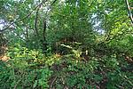
Details:长城类别:单体建筑
经纬高度:东经:124° 12′ 北纬:42° 23′ 海拔:269
建筑形式:现存整体为馒首状,平面为圆形,剖面呈梯形。实际情况不清。
材料:土、石。
附近遗存:西南距离妈妈货郎西山烽火台1千米,西北距离松山堡3.5千米。
Type:烽火台 Beacon Tower
Protection Level:无
Content:
Memo:
Other Records:
Distribution:
visit location in Tianditu Map[recommend] Distribution:
visit location in Tencent QQ Map Distribution:
visit location in Google MapDistribution:
visit location in Baidu MapNational ID:211282353201170062
Action:[
 Save in Data Basket
 ]
Picture:
Click the thumbnail to view the Big Pic. Click the Big Pic to Hide the Big Pic![Caption:靠山屯西山烽火台
loading images --Please wait...]() Photo Links
Photo Links:
 Search ::
  Favorite/My Favorite :: Recent Changes :: :: Login