Official Name:
ТьјҜіӨіЗ1¶ОYinJiChangCheng1DuanOur Name:
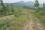
ЕЬВнБл / PaoMaLing
Other Name:
/
Period:ХҪ№ъію / Warring States 475~221 B.C.
Location: әУДПКЎ,ЖҪ¶ҘЙҪКР,ОиёЦКР,ёГ¶ОЖрөгО»УЪцЛЙҪХҜЖрөгЈ¬Ц№өгО»УЪОчАП»ў¶ҙ№ө¶ҘЎЈЙҪПХҙуМеО»УЪОиёЦКРЗшөД¶«ДПІҝЎЈ / HeNanSheng,PingDingShanShi,WuGangShi,GaiDuanQiDianWeiYuShanZhaiQiDianZhiDianWeiYuXiLaoHuDongGouDingShanXianDaTiWeiYuWuGangShiQuDeDongNanBu
ЎЎ[
Looking Local List]
Details:іӨіЗАаұрЈәЗҪМе
ЖрөгҫӯОіёЯ¶ИЈә¶«ҫӯЈә113Ўг 48Ўд ұұОіЈә33Ўг 27Ўд әЈ°ОЈә162
ЦХөгҫӯОіёЯ¶ИЈә¶«ҫӯЈә113Ўг 48Ўд ұұОіЈә33Ўг 26Ўд әЈ°ОЈә474
ЗҪМеЧЯПтЈә»Ж№Піе¶ОЙҪПХҙуМеіКДПұұПтЈ¬іӨФј10057ГЧ
ЙҪПХЈәҙуМеҝЙ·ЦОӘ4РЎ¶ОЎЈ
ЈЁ1Ј©цЛЙҪХҜЖрөгЈӯцЛЙҪХҜёЯС№ПЯ2Ј¬іӨФј237ГЧЎЈёГ¶Оұ»цЛЙҪХҜРЮЧц¶«ЗҪәНДПЗҪЎЈцЛЙҪХҜДҝЗ°·ўПЦТЕОпҪПНнЎЈёщҫЭөШРОҝҙЈ¬ёГ¶ОФЪҪЁХҜЦ®З°Ј¬УҰКЗұ»УГЧцЙҪПХөДөШ¶ОЎЈ
ЈЁ2Ј©цЛЙҪХҜёЯС№ПЯ2ЈӯР»ЙҪДПҪЕЈ¬іӨФј93ГЧЎЈјвЙҪ¶Ҙұ»ҝӘ·ўіЙОӘ¶юАЙЙҪ·зҫ°ЗшЎЈ
ЈЁ3Ј©Р»ЙҪДПЙҪҪЕЕЬВнБлЖрөг-ЕЬВнБлДП¶ЛЈ¬іӨФј8681ГЧЎЈҙЛБлөұөШіЙОӘЕЬВнБлЎЈҫЦІҝіКПЦЙПХӯПВҝнөДМЭРОЎЈ
ЈЁ3Ј©ЕЬВнБлДП¶ЛЈӯОчАП»ў¶ҙ№ө¶ҘЈ¬іӨФј1246ГЧЎЈҙЛ¶Оұ»өұЧч»ДЙҪіР°ьёшёцИЛҝӘ·ўЦЦКчЎЈ
ЗҪМеАаұрЈәЙҪПХ
Ҫб№№МШөгј°№№Цю·ҪКҪЈә
ПЦЧҙЈә
Type:ЙҪПХ Precipitous mountain areas
Protection Level:ОЮ
ЎЎ
Content:
Memo:
Other Records:
Distribution:
visit location in Tianditu Map[recommend] Distribution:
visit location in Tencent QQ Map Distribution:
visit location in Google MapDistribution:
visit location in Baidu MapNational ID:410481382106020034
Action:[
 Save in Data Basket
 ]
Picture:
Click the thumbnail to view the Big Pic. Click the Big Pic to Hide the Big Pic![Caption:ТьјҜіӨіЗ1¶О
loading images --Please wait...]() Photo Links
Photo Links:
ЎЎ Search ::
  Favorite/My Favorite :: Recent Changes :: :: Login