Official Name:
恶石长城EShiChangChengOur Name:
平山县长城2段 / PingShanXianChangCheng2Duan
Other Name:
/
Period:明 / Ming Dynasty 1368~1644
Location: 河北省,石家庄市,平山县,北冶乡恶石村东南0.936千米、平山县02始点 / HeBeiSheng,ShiJiaZhuangShi,PingShanXian,BeiYeXiangEShiCunDongNan0936QianMiPingShanXian02ShiDian
[
Looking Local List]
Details:长城类别:墙体
起点经纬高度:东经:113° 46′ 北纬:38° 9′ 海拔:645
终点经纬高度:东经:113° 46′ 北纬:38° 9′ 海拔:650
墙体走向:
墙体类别:石墙
结构特点及构筑方式:
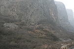
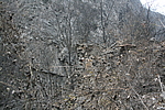
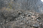
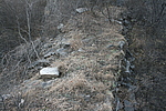
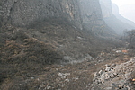
现状:该段墙体共长22米,坍塌严重;地处山西省与河北省交界处,山势陡峭,地处两山之间,该段垒砌较整齐,中间被拆为通道约为2.00米左右;墙体两侧植被覆盖较好,多为荆棘灌木和杂草。
起点:平山县02始点坐标N38°09′42.50″E113°46′31.80″,645m
止点:平山县02止点坐标N38°09′43.10″E113°46′31.30″,650m
Type:石墙 Stone wall
Protection Level:省保
Content:
Memo:
Other Records:
Distribution:
visit location in Tianditu Map[recommend] Distribution:
visit location in Tencent QQ Map Distribution:
visit location in Google MapDistribution:
visit location in Baidu MapNational ID:130131382102170002
The original number submitted by the local government :130131382102170036
(when the Great Wall is identified, the data whose code has been adjusted will display the original number submitted by the local government before revision, which can be used by the local cultural relics department when checking the local data.)
Action:[
 Save in Data Basket
 ]
Picture:
Click the thumbnail to view the Big Pic. Click the Big Pic to Hide the Big Pic![Caption:恶石长城
loading images --Please wait...]()
![Caption:恶石长城
loading images --Please wait...]()
![Caption:恶石长城
loading images --Please wait...]()
![Caption:恶石长城
loading images --Please wait...]()
![Caption:恶石长城
loading images --Please wait...]()
![Caption:恶石长城
loading images --Please wait...]()
![Caption:恶石长城
loading images --Please wait...]() Photo Links
Photo Links:
 Search ::
  My Data Basket ::
  Favorite/My Favorite :: Recent Changes :: :: Login
 Save in Data Basket ]