Official Name:
后喇嘛沟长城HouLaMaGouChangChengOur Name:
大边、边墙 / DaBianBianQiang
Other Name:
/
Period:明 / Ming Dynasty 1368~1644
Location: 陕西省,榆林市,神木县,起点:高家堡镇后喇嘛沟村南200米,止点:高家堡镇后喇嘛沟村南500米 / ShanXiSheng,YuLinShi,ShenMuXian,QiDianGaoJiaBaoZhenHouLaMaGouCunNan200MiZhiDianGaoJiaBaoZhenHouLaMaGouCunNan500Mi
[
Looking Local List]
Details:长城类别:墙体
起点经纬高度:东经:110° 15′ 北纬:38° 37′ 海拔:1097.10
终点经纬高度:东经:110° 15′ 北纬:38° 37′ 海拔:1093.80
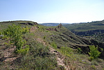
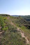
墙体走向:现存墙体位于后喇嘛沟村南喇嘛沟南岸上,整体走向为东北-西南;GPS440点至GPS442点段段走向为北-南,GPS442点至GPS444点走向为东北-西南。
特征点如下:
GPS440点,起点
GPS442点,拐点,东经:110°15′57.03″,北纬38°37′37.37″,高程:1099.90米
GPS443点,断点,东经:110°15′55.51″,北纬38°37′33.60″,高程:1090.40米
GPS444点,止点
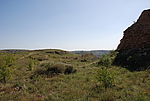
GPS440点至GPS442点段,夯土墙,长72米;墙体在起点GPS440点处由0051墙体的东北-西南走向拐成北-南走向,墙体在GPS442点处拐向西南,成东北-西南走向。在GPS442点北12米处有一条沟壑穿过墙体,形成一个豁口,造成墙体消失10米。
GPS442点至GPS443点段,夯土墙,长103米;在GPS443点处有一断口,为流水冲毁,造成墙体消失10米。
GPS443点至GPS444点段,夯土墙,长88米。
墙体类别:土墙
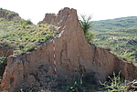
结构特点及构筑方式:GPS443点底宽8.6米,上宽0.3米,内高2.8米,外高5.6米。自然基础上人工筑成。
现状:土墙。
Type:土墙 Rammed earth wall
Protection Level:无
Content:
Memo:
Other Records:
Distribution:
visit location in Tianditu Map[recommend] Distribution:
visit location in Tencent QQ Map Distribution:
visit location in Google MapDistribution:
visit location in Baidu MapNational ID:610821382101170052
Action:[
 Save in Data Basket
 ]
Picture:
Click the thumbnail to view the Big Pic. Click the Big Pic to Hide the Big Pic![Caption:后喇嘛沟长城
loading images --Please wait...]()
![Caption:后喇嘛沟长城
loading images --Please wait...]()
![Caption:后喇嘛沟长城
loading images --Please wait...]()
![Caption:后喇嘛沟长城
loading images --Please wait...]() Photo Links
Photo Links:
 Search ::
  My Data Basket ::
  Favorite/My Favorite :: Recent Changes :: :: Login
 Save in Data Basket ]


