Official Name:
黄天棉图长城12段HuangTianMianTuChangCheng12DuanOur Name:
/
Other Name:
/
Period:战国秦、汉 / Han Dynasty 206 B.C.~316A.D.
Location: 内蒙古自治区,鄂尔多斯市,准格尔旗,准格尔召镇黄天棉图村东南8.7千米处-东南8.8千米处 / NeiMengGuZiZhiQu,EErDuoSiShi,ZhunGeErQi,ZhunGeErZhaoZhenHuangTianMianTuCunDongNan87QianMiChuDongNan88QianMiChu
[
Looking Local List]
Details:长城类别:墙体
起点经纬高度:东经:110° 18′ 北纬:39° 40′ 海拔:1403
终点经纬高度:东经:110° 18′ 北纬:39° 40′ 海拔:1424
墙体走向:大致呈东-西走向。
墙体类别:石墙
结构特点及构筑方式:呈梯形。高1米,基宽4米,顶宽2.8米。土石混筑而成墙体,基宽顶窄。高1米,基宽4米,顶宽2.8米。
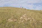
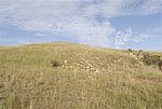
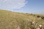
现状:石墙。全长112米,保存一般,墙体坍塌,呈土垅状,石块散落于地表。高1米,基宽4米,顶宽2.8米。
Type:石墙 Stone wall
Protection Level:国保
Content:
Memo:
Other Records:
Distribution:
visit location in Tianditu Map[recommend] Distribution:
visit location in Tencent QQ Map Distribution:
visit location in Google MapDistribution:
visit location in Baidu MapNational ID:150622382102040032
Action:[
 Save in Data Basket
 ]
Picture:
Click the thumbnail to view the Big Pic. Click the Big Pic to Hide the Big Pic![Caption:黄天棉图长城12段
loading images --Please wait...]()
![Caption:黄天棉图长城12段
loading images --Please wait...]()
![Caption:黄天棉图长城12段
loading images --Please wait...]() Photo Links
Photo Links:
 Search ::
  My Data Basket ::
  Favorite/My Favorite :: Recent Changes :: :: Login
 Save in Data Basket ]

